| ultramarin marine translations |
| ultramarin.online | ||||
| Apalachicola | rivier in het noordwesten van Florida
die ontstaat uit de samenvloeiing van de rivieren Flint
en Chattahoochee bij de Jim
Woodruff stuw bij de stad Chattahoochee. Na 180 km watert de rivier uit
in de baai van Apalachicola en vervolgens in de Golf
van Mexico. The laatste 10 km wordt de rivier gebruikt door de
Gulf Intracoastal Waterway. De sluis bij de Jim Woodruff dam is de enige met afmetingen van 145 m x 27 m en een hefhoogte van max. 11 m. |
|||
| Apalachicola | Strom in Nordwest-Florida, der aus dem Zusammenfluß
der Flüsse Flint und Chattahoochee
beim Jim Woodruff Damm nahe der Stadt Chattahoochee entsteht und nach
180 km in die Apalachicola Bay des Golfs
von Mexiko fließt. The letzten rd.10 km bildet der Flußlauf
den Gulf Intracoastal Waterway. Die einzige Staustufe mit einer Schleuse (145m x 27m) mit einer Hubhöhe von max. 11m liegt rd. 300 m unterhalb des Zusammenflusses. |
|||
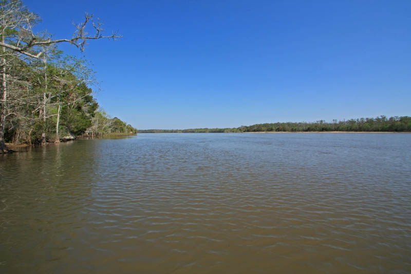
| Apalachicola River | navigable river, approximately 112 mi long, formed
by the confluence of the Flint and
Chattahoochee Rivers at the
Jim Woodruff Lock and Dam, Chattahoochee, Florida. It discharges into
Apalachicola Bay at the city of Apalachicola. The last 7 miles
are identical with the Gulf
Intracoastal Waterway. Jim Woodruff is the only lock and dam, with a lock of 450ft x 82ft and a max. lift of 33ft. |
|||
| Apalachicola (rivière) | ||||
 |
||
Apalachicola River |