| Schon im
17.Jahrhundert träumten die Bürger von Kleve vom Anschluß ihrer
Stadt an den Rhein. Ein erstes Kanalprojekt, das von Prinz Moritz von
Nassau unterstützt wurde, scheiterte 1666 aus Geldmangel. 1688
erteilte der Große Kurfürst eine weitere Genehmigung für den Bau
einer Wasserstraße, die zu dem kleinen Hafen östlich der Stadt führt.
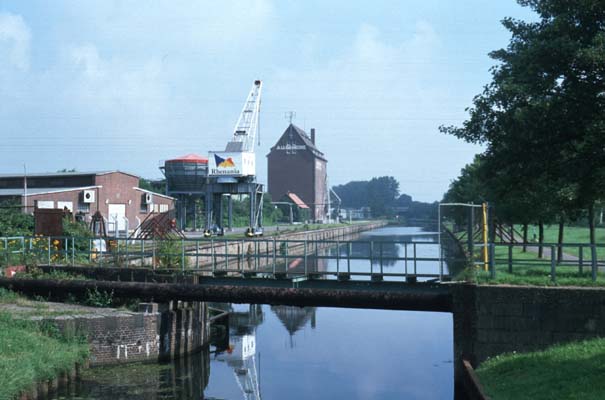
Die heutige Gestalt des Hafens geht im wesentlichen auf den
Eisenbahnanschluß zurück, der Anfang des 20.Jahrhunderts üblich
wurde und 1907/10 Anlaß für eine Erweiterung gab. Erlaubte die alte
Eisenbahnbrücke, ursprünglich als Dreh-, nach ihrer Sprengung im
Krieg als Klappbrücke wiederhergestellt, noch die Durchfahrt in den
westwärtigen Teil, so versperrt mittlerweile eine Rohrleitung den Weg
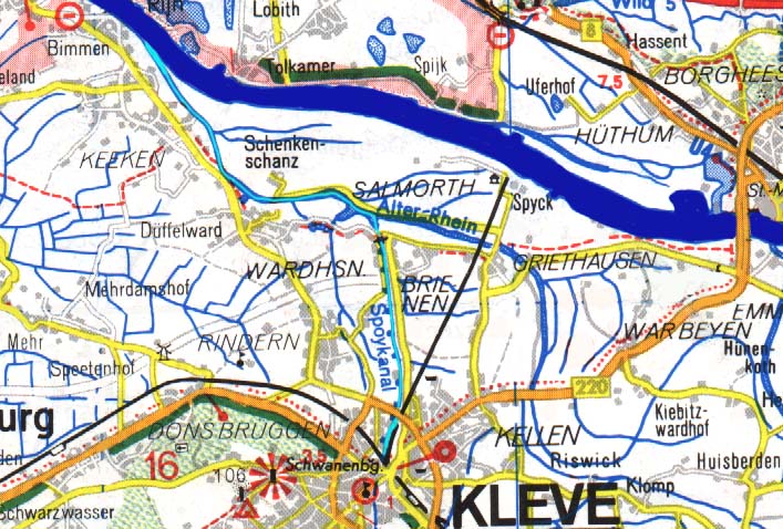
in den alten Teil. Der 10 Kilometer lange Schiffahrtsweg über den
Griethauser Altrhein und den Spoykanal erlaubt Abladetiefen bis 2,50,
ist aber wegen der Schleuse bei Brienen auf Schiffe bis 67 Meter Länge
und 8,20 Meter Breite beschränkt. Neben dem Umschlag von Massengütern
dient der Hafen vor allem der Anfuhr von Öl für die
Speisefettindustrie. |
| The
citizens of Cleve had harboured the idea to connect their town to the
traditional continental trade route of the Rhine for quite some time
when a first undertaking of this kind was supported by the Prince
Moritz von Nassau. This project of 1666 having failed due to budgetary
underfunding, another permission was granted in 1688 by the state of
Brandenburg, leading to the construction of a small port east of the
town. However, the port in its present form dates back to the fin
de sičcle, when the city was connected to the railway network.
The subsequent increase in traffic demanded an early expansion of the
port, carried out between 1907-1910. Thus the railway line came to
cross the port over a turning bridge which was replaced by a
cantilever bridge after its destruction during WWII. Later on the way
into the old western part became blocked by a pipeline-flyover which
together with the bridge is now situated at the end of the new port (both
the port and the actual canal beginning
at km 0,44)
The waterway (10,14 km) follows the course of
the Griethauser Altrhein from Rhine-km 863,90 (left bank),
until it turns into the Spoykanal at km 4,32. It is navigable
for vessels up to a draught of 2.20 m. Their overall dimensions are
limited to 67m x 8,20m by the size of the (only) lock at Brienen
connecting the old Rhine to the canal. Apart from the import of bulk
cargo (gravel) the port is frequented by tankers, discharging oil for
the local vegetable fat industry. |