| no |
name |
mile |
from
<> to
max.
length x beam ft (m) |
connections
/ branches
max. draught cm |
| |
Middle
Level Navigation |
|
|
|
| |
King's
Dyke |
4.3 |
Whittlesey
Bridge
<>
Stanground Sluice |
|
|
|
|
72
x 13 (22 x 3,96) |
|
| |
Whittlesey
Bridge
|
0.0 |
|
MLN
Whittlesey Dyke |
| |
Stanground
Sluice |
4.3 |
|
River
Nene - Stanground Branch |
| |
|
|
|
|
| |
Whittlesey
Dyke |
6.1 |
Whittlesey
Dyke Junction
<>
Whittlesey Bridge |
MLN
Old River Nene
MLN Bevill's Leam Angle Corner to Pumping Station
MLN Twenty Foot River
MLN King's Dyke |
| |
|
|
60
x 13 (18,3 x 3,96) |
|
| |
Whittlesey
Dyke Junction |
0.0 |
|
MLN
Old River Nene |
| |
Angle
Corner |
3.3 |
|
MLN
Bevill's Leam: Angle C.-Pumping St.
MLN Twenty Foot River |
1 |
Ashline
Sluice |
5.6 |
|
|
| |
Whittlesey
Bridge |
6.1 |
|
MLN
King's Dyke |
| |
|
|
|
|
| |
Bevill's
Leam
Angle Corner to Pumping Station |
4.9 |
Bevill's
Leam Pumping Station
<>
Angle Corner |
MLN
Whittlesey Dyke
MLN Twenty Foot River |
| |
|
|
72
x 13 (22 x 3,96) |
|
| |
Bevill's
Leam Pumping Station
|
0.0 |
|
--end
of navigation-- |
| |
Angle
Corner |
4.9 |
|
MLN
Whittlesey Dyke
MLN Twenty Foot River |
| |
|
|
|
|
| |
Bevill's
Leam
Mere Mouth to Pumping Station |
0.1 |
Bevill's
Leam Pumping Station
<>
Bevill's Leam-Black Ham Drain Jct |
MLN
Black Ham Drain
MLN Old River Nene |
| |
|
|
72
x 13 (22 x 3,96) |
|
| |
Bevill's
Leam Pumping Station
|
0.0 |
|
|
| |
Bevill's
Leam-Black Ham Drain Jct |
0.1 |
|
MLN
Black Ham Drain
MLN Old River Nene |
| |
|
|
|
|
| |
Black
Ham Drain |
3.0 |
Bevil's
Leam-Black Ham Drain Jct
<>
Black Ham Pumping Station |
MLN
Bevill's Leam Mere Mouth to Pumping Station
MLN Old River Nene
MLN Yaxley Lode |
| |
|
|
72
x 13 (22 x 3,96) |
|
| |
Bevil's
Leam-Black Ham Drain Jct |
0.0 |
|
MLN
Bevill's Leam Mere Mouth to Pumping Station
MLN Old River Nene |
| |
Black
Ham Pumping Station |
3.0 |
|
MLN
Yaxley Lode |
| |
|
|
|
|
| |
Yaxley
Lode |
0.6 |
Yaxley
Foot Bridge
<>
Black Ham Pumping Station |
MLN
Black Ham Drain |
| |
|
|
72
x 13 (22 x 3,96) |
|
| |
Yaxley
Foot Bridge |
0.0 |
|
--end
of navigation-- |
| |
Black
Ham Pumping Station |
0.6 |
|
MLN
Black Ham Drain |
| |
|
|
|
|
| |
Old
River Nene |
26.1 |
Old
River Nene - Black Ham Drain Jct
<>
Outwell |
MLN
Bevill's Leam Mere Mouth to Pumping Station
MLN Black Ham Drain
MLN Whittlesey Dyke
MLN Forty Foot River
MLN Twenty Foot River
MLN New Dyke
MLN Ramsey High Lode
MLN Popham's Eau
MLN Well Creek |
| |
|
|
72
x 13 (22 x 3,96) |
|
| |
Old
River Nene - Black Ham Drain Jct |
0.0 |
|
MLN
Bevill's Leam Mere Mouth to Pumping Station
MLN Black Ham Drain |
| |
Old
River Nene - New Dyke Jct |
2.8 |
|
MLN
New Dyke |
1 |
Lodes
End Lock |
5.8 |
|
|
| |
|
5.8 |
|
MLN
Ramsey High Lode |
| |
|
6.6 |
|
MLN
Forty Foot River |
| |
|
13.3 |
|
MLN
Whittlesey Dyke |
| |
|
22.4 |
|
MLN
Popham's Eau |
2 |
Marmont
Priory Sluice |
24.1 |
|
|
| |
Outwell |
26.1 |
|
MLN
Well Creek |
| |
|
|
|
|
| |
New
Dyke |
3.3 |
Holme
<>
Old River Nene - New Dyke Jct |
MLN
Monks Lode
MLN Great Raveley Drain
MLN Old River Nene |
| |
|
|
72
x 13 (22 x 3,96) |
|
| |
Holme |
0.0 |
|
--end
of navigation-- |
| |
|
1.6 |
|
MLN
Monks Lode |
| |
|
2.7 |
|
MLN
Great Raveley Drain |
| |
Old
River Nene - New Dyke Jct |
3.3 |
|
MLN
Old River Nene |
| |
|
|
|
|
| |
Great
Raveley Drain |
2.7 |
Great
Raveley Drain Foot Bridge No. 2
<>
New Dyke - Great Raveley Drain Jct |
MLN
New Dyke |
| |
|
|
72
x 13 (22 x 3,96) |
|
| |
Great
Raveley Drain Foot Bridge No. 2 |
0.0 |
|
--end
of navigation-- |
| |
New
Dyke - Great Raveley Drain Jct |
2.7 |
|
MLN
New Dyke |
| |
|
|
|
|
| |
Ramsey
High Lode |
1.1 |
Ramsey
<>
Old River Nene - Ramsey High Lode Jct |
MLN
Old River Nene |
| |
|
|
72
x 13 (22 x 3,96) |
|
| |
Ramsey |
0.0 |
|
--end
of navigation-- |
| |
Old
River Nene-Ramsey High Lode Jct |
1.1 |
|
MLN
Old River Nene |
| |
|
|
|
|
| |
Well
Creek |
5.4 |
Outwell
<>
Salter's Lode Junction |
MLN
Old River Nene
River Great Ouse - New Bedford River
River Great Ouse - Large Tidal Section |
| |
|
|
72
x 13 (22 x 3,96) |
|
| |
Outwell |
0.0 |
|
MLN
Old River Nene |
1 |
Salter's
Lode Lock |
5.4 |
|
|
| |
Salter's
Lode Junction |
5.4 |
|
River
Great Ouse - New Bedford River
River Great Ouse - Large Tidal Section |
| |
|
|
|
|
| |
Popham's
Eau |
2.3 |
Three
Holes
<>
Old River Nene - Popham's Eau Jct |
MLN
Sixteen Foot River
MLN Middle Level Main Drain
MLN Old River Nene |
| |
|
|
72
x 13 (22 x 3,96) |
|
| |
Three
Holes |
0.0 |
|
MLN
Sixteen Foot River
MLN Middle Level Main Drain |
| |
Old
River Nene - Popham's Eau Jct |
2.3 |
|
MLN
Old River Nene |
| |
|
|
|
|
| |
Twenty
Foot River |
10.4 |
Old
River Nene - Twenty Foot River Jct
<>
Angle Corner |
MLN
Old River Nene
MLN Whittlesey Dyke
MLN Bevill's Leam: Angle Corner to Pumping Station |
| |
|
|
72
x 13 (22 x 3,96) |
|
| |
Old
River Nene - Twenty Foot River Jct |
0.0 |
|
MLN
Old River Nene |
| |
Angle
Corner |
10.4 |
|
MLN
Whittlesey Dyke
MLN Bevill's Leam: Angle Corner to Pumping Station |
| |
|
|
|
|
|
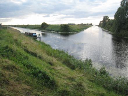
Junction
of Sixteen Foot River, Popham's Eau and Middle Level Drain (Three Holes) |
| |
|
|
|
photo:
canalplan.org.uk/Tim Lewis |
| |
Sixteen
Foot River |
9.6 |
Three
Holes
<>
Sixteen Foot Corner |
MLN
Middle Level Main Drain
MLN Popham's Eau
MLN Forty Foot River |
| |
|
|
72
x 13 (22 x 3,96) |
|
| |
Three
Holes |
0.0 |
|
MLN
Middle Level Main Drain
MLN Popham's Eau |
| |
Sixteen
Foot Corner |
9.6 |
|
MLN
Forty Foot River |
| |
|
|
|
|
| |
Forty
Foot River |
10.0 |
Forty
Foot River - Old Bedford River Jct
<>
Old River Nene - Forty Foot River Jct |
River
Great Ouse - Counter Wash Drain
River Great Ouse - Old Bedford River
MLN Sixteen Foot River
MLN Old River Nene |
| |
|
|
72
x 13 (22 x 3,96) |
|
| |
Forty
Foot River-Old Bedford River Jct |
0.0 |
|
River
Great Ouse - Counter Wash Drain
River Great Ouse - Old Bedford River |
1 |
Welches
Dam Sluice |
0.0 |
|
|
2 |
Horseway
Sluice |
1.4 |
|
|
| |
Sixteen
Foot Corner |
2.2 |
|
MLN
Sixteen Foot River |
| |
Old
River Nene - Forty Foot River Jct |
10.0 |
|
MLN
Old River Nene |
| |
|
|
|
|
| |
Monks
Lode |
2.0 |
New
Dyke - Monks Lode Jct
<>
Monks Lode Footbridge |
MLN
New Dyke |
| |
New
Dyke - Monks Lode Jct |
0.0 |
|
MLN
New Dyke |
| |
Monks
Lode Footbridge |
2.0 |
|
--end
of navigation-- |
| |
|
|
|
|
| |
Middle
Level Main Drain |
2.0 |
Three
Holes
<>
Mullicourt Aqueduct |
MLN
Sixteen Foot River
MLN Popham's Eau
|
| |
|
|
72
x 13 (22 x 3,96) |
|
| |
Three
Holes |
0.0 |
|
MLN
Sixteen Foot River
MLN Popham's Eau |
| |
Mullicourt
Aqueduct |
2.0 |
|
--end
of navigation-- |
| |
|
|
|
|
 |
Jim
Shead's Waterways Information
Waterway
Gazeteer |
|